Capital : Tabanan
Highest Peak : Mt. Batukau – 2.276 meters above sea level
Location : South-Western Bali
Important Phone Numbers :
Direct Inquiries : 0361 108
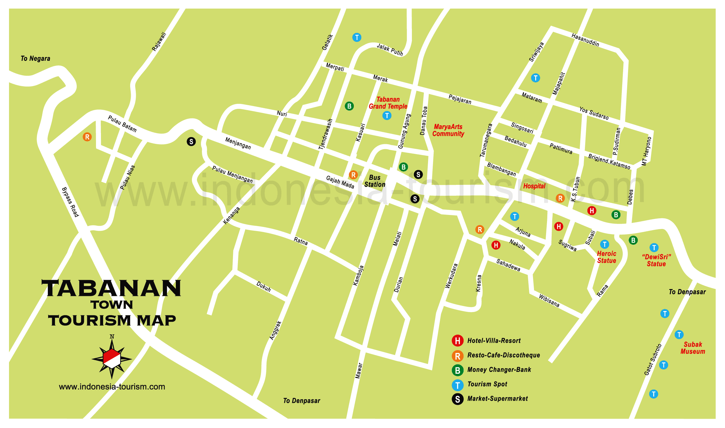
Tabanan Tourist Office Address : Jl. Gunung Agung – Tabanan.
Phone : 0361 811602
Tabanan is one of nine districts and municipalities that exist in the province of Bali, is located on the southern island of Bali. Tabanan Regency has an area of 839.33 sq KM area consisting of mountains and beaches. By geographical region of Tabanan Regency is located between 1140 to 54 ’52 “east longitude and 80 14′ 30” – 80 30’07 “south latitude. The boundaries of the Tabanan region include: the north bordering the Buleleng district, bordered by a row of mountains like Mount Batukaru (2276 m), Mount Sanghyang (2023 m), Mount Pohen (2051 m), Mill Mountain (2082 m ), and Mount Beratan (2020 m); on the east by the Badung Regency, which is limited by Yeh Tukad Sungi, Tukad Ukun and Tukad Yeh Penet. In the south bordered by the Indian Ocean, with a width of 37 km long coast, the west borders the Jembrana district bounded by Yeh Let Tukad.
Tabanan region is one of the 9th Districts of the total area of 839.33 km2 or 14.90% of Bali province and lies at an altitude region from 0 to 2276 m above sea level. A total of 23,358 hectares or 28.00% of land area in Tabanan Regency is wet land, so the Tabanan Regency is known as an agricultural area. As has been understandably together, that the potential is superior Tabanan agriculture because they most livelihoods, the cornerstone of the regional economy and land use Tabanan region still dominated the field of agriculture in the broad sense. Tabanan Regency consists of 10 Districts (District Tabanan, Kediri District, District Kerambitan, Selemadeg District, West Selemadeg District, Eastern District Selemadeg, Penebel District, District Pupuan, Marga district, and District Baturiti), in Tabanan Regency administration in 2006 has 123 villages offices, 345 small villages, 784 train services and 365 water control system, with a population of 410,162 inhabitants as of 2006 consisted of 203,394 people at the male and female population of 206,768 inhabitants.
There are 25 objects and attractions consist of natural attractions as much as 17 objects, historical sights as many as 1 object and cultural sights as many as 7 of the object and has a five-star hotel accommodation tourism as much as 2 units with a capacity of 225 rooms, as many as 28 pieces of jasmine hotels (hotel melati) with a capacity of 381 rooms and 40 cottage units with a capacity of 244 rooms. The number of restaurants 45 restaurant and restaurant 2 restaurants.
Geography
Geographically Tabanan Regency has strategic position because it located between Badung Regency in the east and Buleleng Regency in the north, Jembrana Regency in the west and Indonesian Ocean in the south. This regency is also has some potential tourism object like Tanah Lot Temple and it Beach, Klating Beach, Soka Beach, Bedugul, Alas Kedaton and other objects that potential to be developed.
Overview
At Menalun village, 15 kilometer from Denpasar, is the unique Alas Kedaton Temple. There are four gates leading to the temple – the split gate standing in the middle of the yard and the south, north and east gates. This temple is 300 years old and in it are kept relics of the old megalithic period. Margarana Heros’ Cemetery, is a monument 25 kilometers from Denpasar. A battle was once waged here on the paddies of Uma Karang. The current monument was erected to remember the death of I Gusti Ngurah Rai, a leader of Ciung Wanara regiment who died in a more recent battle against the Dutch, on November 20, 1946. Denpasar’s international airport is named after him. Kerambitan village is located seven kilometers west of Tabanan. It is a village of craftsmen. Kelating beach nearby is good for surfing. The andir dance is one of the area’s strong tourist attractions. Puri Gede kerambitan temple is also found here. Not far from here, about two kilometers away, is Bedugul, a cool mountain resort. Bedugul lies at an elevation of 1,240 meters above sea level.
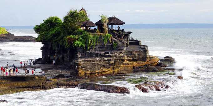
The average temperature is 18 0 centigrade during the night and 24 0 centigrade during the day. The beautiful scenery can be enjoyed from the side of Lake Beratan . From here one can see the vegetable gardens at the north side of the lake. This region produces flowers. The lakeside is often used as camping ground. A splendid golf field is found at Pancasari village, three kilometers toward the north. Two kilometers toward the west is a botanical garden with various species of flora. Tanah Lot temple is famous. Located 13 kilometers away from Tabanan, the temple stands on top of a rock that must once have been a promontory, jutting out into the gulf. During high tide, the huge waves of the Indian Ocean lash the base of the rock, breaking into white foam, During low tide, one can walk to the temple. Several meru (pagoda) stand here amidst the scenery. Harmless sea-snakes are found are considered sacred by the people, so they must not be disturbed.
Kedungu Beach is located to the west of Tanah Lot, 32 kilometers from Denpasar. It has black san and the waves are big. From there, one can visit Pasut Beach, which is not far away. At a distance of 34 kilometers from Denpasar, via Tabanan and futher to the north, is the hot-water pool of Panatahan, which is popularly known as Yeh Panes. The water contain sulfur. Luhur Watu Karu Temple is found at Wangaya Gde village, 42 kilometers from Denpasar. Relics of history, such asancient spears and statues, are kept here. Soka Beach lies at a distance of 46 kilometers from Denpasar, towards the west, on the road between Denpasar and Gilimanuk. Batulumbung Beach is at the other side of the beach. The view are beautiful.Further down the road is Payan Beach , with corals in the clear blue sea. The beach slopes gently ut the waves are big. Yeh Gangga, is a beach 11 kilometers from the main road between Tabanan and Gilimanuk. This beach has black sand. The sea is calm and quite unlike at Tanah Lot. Jati Luwih is a highland resort in the northern part of the Tabanan region. The air is cool hare at a height of 700 meters above sea level. The vistas of this are among the most impressive of Bali.
History
Founded in the 14th century Tabanan had a mixed history with numerous conflicts, mainly with the neighboring kingdom of Mengwi. By the end of the 1700’s Tabanan had managed to claim part of the Mengwi Kingdom however lost it back to the Mengwi Royal household by the mid 1800’s. By 1906 the Dutch having conquered Tabanan, imprisoned the king and his son.
Place of Interest in Tabanan Regency :
- Alas Kedaton Monkey Forest
- Bali Botanical Garden
- Bali Butterfly Park
- Batukaru Temple
- Beratan Lake
- Fruit and Vegetable Market Bedugul
- Jatiluwih Rice Terrace
- Margarana Memorial
- Penatahan Hot Spring
- Tanah Lot Temple
- Ulundanu Temple
(click Image to Enlarge)


